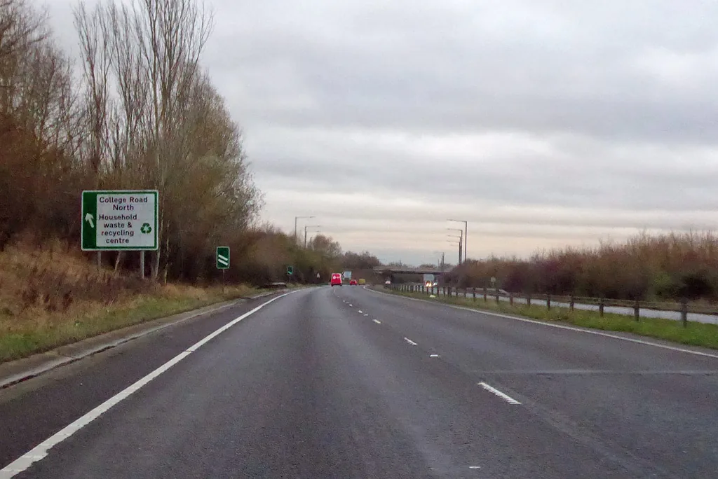

Blackgrove Road at Waddesdon is shut around the clock to Friday 25 September, and the M40 northbound junction 9 entry slip closes overnight on 28 September.
Two closures matter this week, one local and one on the motorway.
Blackgrove Road at Waddesdon is shut 24 hours a day until Friday 25 September. It then shuts again for a second phase from Monday 29 September to Friday 9 October, weekdays only. Waddesdon is about six miles north-west of Aylesbury on the A41.
On the motorway, the M40 northbound is being closed a section at a time overnight. The stretch between junction 9 and junction 10 closes from 22.15 on Wednesday 23 September to 6am, with the junction 9 entry slip and the junction 10 exit slip shut as well. Junction 9 is the one Aylesbury reaches on the A41 through Bicester. The junction 9 entry slip closes again on the night of Monday 28 September.
Buckinghamshire Council publishes its own planned works list separately from the map. The version on its roadworks page still carries the line “Last updated on Friday 18 September”, checked again on Wednesday 23 September. Nothing on it has changed since last week, so anything on it that has already finished has simply been left there. The council warns on the same page that dates change at short notice for weather and materials.
What is closed in the Aylesbury area now
| Where | When | What |
|---|---|---|
| Blackgrove Road, Waddesdon (phase 1) | Monday 7 to Friday 25 September | Carriageway surfacing under a 24 hour road closure throughout |
| Blackgrove Road, Waddesdon (phase 2) | Monday 29 September to Friday 9 October | Carriageway surfacing under a road closure, 7am to 7pm Monday to Friday only |
| London Road, Buckingham | Tuesday 22 to Saturday 26 September | Ironworks under stop and go boards and two-way lights, 7am to 7pm, including the Saturday |
| Pedestrian and zebra crossings, countywide | Monday 7 to Friday 25 September | Crossings refreshed in Aylesbury and elsewhere using a new MMA material. Each closure lasts around two hours while the material cures |
| Column stump replacements, countywide | Monday 29 June to Thursday 15 October | Forty damaged street lighting assets replaced with new columns and LED lanterns, including in Aylesbury, Buckingham, Fairford Leys, Calvert Green, Great Horwood and Biddlesden |
| Capital lining refresh, countywide | 17 August to Friday 16 October | Centre lines, give-way markings, road studs, high friction surfacing and lane markings renewed, including in Aylesbury, Buckingham, Beachampton and Wing. Some night closures |
One job on last week’s version of this page has now finished. The overnight retexturing of the A413 Buckingham Road at Winslow was listed to Saturday 19 September and is out of date on the council’s list rather than off it, because the list has not been republished since. If signs or cones are still out there, the council asks residents to report the location on FixMyStreet.
Note what the table does not cover. The council’s list does not include utility company works, so water, gas and broadband digs are permitted separately and only appear on the interactive map. A street that looks clear here can still be dug up. You can set up alerts on One.Network for routes you use often, which is the only way to see everything in one place.
The fortnight ahead, road and rail
The M40: Aylesbury’s junction 9 shuts twice in six nights
National Highways is working its way up the northbound carriageway a section at a time, and two of the nights take in junction 9. Aylesbury joins the M40 at junction 8a, reached on the A418 through Thame, and at junction 9, reached on the A41 through Bicester.
| Night | What closes | Times |
|---|---|---|
| Wednesday 23 September | Northbound carriageway, junction 9 to junction 10, plus the junction 9 entry slip and the junction 10 exit slip | 22.15 to 06.00 |
| Thursday 24 September | Southbound junction 11 entry slip, at the Banbury end | 22.15 to 06.00 |
| Monday 28 September | Northbound junction 9 entry slip | 22.15 to 06.00 |
| Monday 28 September | Northbound carriageway, junction 11 to junction 12, plus the junction 11 entry slip and the junction 12 exit slip | 22.15 to 06.00 |
Wednesday night is the one that removes the town’s access northwards. If you join at junction 9 for Banbury or Birmingham after 10.15pm, you will not be able to get on at all, and the diversion is on local authority roads. Monday night is lighter: the carriageway is open but the junction 9 entry slip is not, so northbound traffic has to run on to junction 10 at Ardley.
One more is worth knowing for late runs to Heathrow. The link road from M40 junction 1A westbound to the M25 at junction 16, clockwise and anti-clockwise, closes 22.00 to 05.30 on the nights of Tuesday 22, Wednesday 23, Thursday 24 and Friday 25 September for safety fence repairs.
National Highways publishes the detail as a spreadsheet download from its road closure report page, and the link changes each time, so it has to be taken from that page rather than bookmarked. The file used here covers the nights of Tuesday 22 to Monday 28 September. Its front page says a new list goes up each day, and adds: “Understandably plans can sometimes change, and it is for this reason we recommend you regularly visit the webpage to view the most up-to-date closure list.”
Six rail dates before the middle of October
The Aylesbury line has something on it most nights for the next fortnight. All of it is late evening apart from the two Wembley match days.
- Wednesday 23 September. Routine maintenance in the Oxford area closes the railway there after midnight. The 22.34 and 00.01 Marylebone to Oxford are diverted to terminate at Bicester North, the 23.11 Marylebone to Oxford and Banbury leaves five minutes later at 23.16 and also terminates at Bicester North, and the 00.22 Oxford to Banbury is cancelled. Separately, the 23.16 Marylebone to Aylesbury via High Wycombe leaves five minutes earlier, at 23.11. (Chiltern Railways, Wednesday 23 September)
- Saturday 26 September. England play Spain at Wembley with a 7.45pm kick-off. The 17.27 and 18.27 Marylebone to Aylesbury are both cancelled, and after about 8pm the Amersham to Aylesbury Vale Parkway replacement buses run instead of trains, connecting with Metropolitan line trains at Amersham. (Chiltern Railways, Saturday 26 September)
- Monday 28 and Tuesday 29 September. Maintenance at Aylesbury closes the railway between Aylesbury and Aylesbury Vale Parkway after 22.45, with buses between the two stations. (Chiltern Railways, Monday 28 September)
- Wednesday 30 September and Thursday 1 October. Maintenance closes the line between Princes Risborough and Aylesbury after midnight, with buses calling at Little Kimble. (Chiltern Railways, Wednesday 30 September)
- Saturday 3 and Sunday 4 October. Oxford-area work again, this time closing the railway between Oxford Parkway and Oxford after 22.55 on the Saturday and until 08.35 on the Sunday. Aylesbury services are not affected, but a Bicester Village trip is. (Chiltern Railways, Saturday 3 October)
- Tuesday 6 October. England play Czechia at Wembley, 7.45pm, and this one lands in the weekday peak. The 17.37 Marylebone to Princes Risborough is cancelled, and three Aylesbury departures run short: the 17.41 and 18.11 via Amersham drop from four carriages to three, and the 18.30 to Aylesbury Vale Parkway leaves a minute later at 18.31 with two carriages instead of three. (Chiltern Railways, Tuesday 6 October)
Chiltern’s calendar only shows “minor change” or “major change” against a date. The detail sits on a separate page for each day, which is where all of the above comes from.
The A41 Woodlands roundabout: the start date has now passed
The single biggest change to driving in Aylesbury over the next year was due to begin this month, and there is still nothing new on the record.
The council’s project page continues to give mid-September 2026 as the start of main construction works, with completion in summer 2027. Checked again on 23 September, with mid-September gone, it carries no progress update and no traffic management plan. (Buckinghamshire Council project page)
The work is being carried out by Taylor Wimpey rather than the council, as part of the Hampden Fields development. Planning approval came in February 2026, the project started in April and equipment went to site in May. What is being built at the junction of Aston Clinton Road, Aylesbury Road and the A41 dual carriageway:
- the current Woodlands roundabout is demolished
- a hamburger-style roundabout is built in its place, around three times larger
- Aston Clinton Road is widened
- the new Southern Link Road into Hampden Fields is created
- the overhead electricity cables to the south of the road go underground
The A41 east is the town’s only dual carriageway out and its main strategic link, so this is the scheme most likely to affect your journey between now and next summer. The council refers all enquiries about it to Taylor Wimpey.
The routes that carry the town
Practically, that means four things worth knowing before you set off.
East is the fast way out. The A41 toward Aston Clinton and Tring is dual carriageway and the town’s main strategic link. West on the A418 to Thame and the M40 is single carriageway most of the way.
The A413 does two jobs. It runs north from Aylesbury to Winslow and Buckingham and south to Wendover and Amersham, and both halves carry commuter traffic at the same time of day.
The A4010 south has changed shape. The Stoke Mandeville Relief Road realigned it, and the first section of the new link road opened alongside it in November 2025.
Buckingham looks north, not south. Its road traffic runs to Milton Keynes on the A421 rather than to Aylesbury, which is one reason the two halves of this district behave like separate places.
The link road that is supposed to finish this autumn
The South East Aylesbury Link Road (SEALR) is the biggest change to the road network here in years, and the council’s project page still gives its completion date as autumn 2026. That is now.
It is 1.1 miles of dual carriageway joined by three roundabouts, forming part of what the council calls the Aylesbury Orbital Link Road. Phase 1 runs from the B4443 Lower Road to the A413 Wendover Road and includes a road bridge over the Aylesbury to Marylebone railway line. Phase 2 adds about 500 metres of dual carriageway and a roundabout connecting the Stoke Mandeville Relief Road to a future South West Aylesbury Link Road.
The council’s list of completed work on phase 1 now includes the eastern side of the Wendover Road roundabout and the Thames Water trunk main diversion. What it lists as still to come on phase 1 is the part that decides the opening date:
- ground improvement works between Wendover Road and the railway
- sheet piling either side of the railway
- connecting the Lower Road roundabout to the existing Lower Road carriageways
- completing the mainline drainage between the Lower Road roundabout and the new flood alleviation pond west of the railway
Sheet piling either side of the railway is the stage before the bridge, and it is still listed as a next step with autumn already here. That list had not changed when we checked it again on 23 September. Phase 2 is further back again: the council puts its own Thames Water trunk main diversion at “approximately 60% complete”, and its next steps are completing the earthworks, starting the drainage pipes and starting pavement construction.
The dates behind it: the project started in June 2016, main line construction began in February 2023, and approval to build every element of both phases was granted in autumn 2024. The first section opened in November 2025 alongside the Stoke Mandeville Relief Road. The council has not moved the autumn 2026 date, and it runs a project newsletter you can sign up to on the same page.
HS2 in the north of the county
HS2 Phase 1 runs about 60 kilometres through Buckinghamshire, and the heaviest construction in this district has been around Calvert, north-west of Aylesbury. The council is blunt about its own position: the HS2 Rail Act 2017 granted outline planning permission and gives the Secretary of State wide powers, approval “is not to be unreasonably withheld”, and if the council does not respond to an HS2 consent request within the set timescale, approval is deemed granted. In its own words, the council has “little or no power to change aspects of the scheme”.
The route to Manchester was cancelled in October 2023 and the eastern leg earlier than that, so the line now stops at Birmingham. The construction traffic through the north of the vale does not.
What it means for you
- Wednesday night is the M40 night. The northbound carriageway between junctions 9 and 10 is shut from 22.15 to 6am, and so is the junction 9 entry slip. If you use the motorway late for Bicester, Banbury or Birmingham, go before 10pm or take the A41 all the way.
- Junction 9 shuts again on Monday. On 28 September the carriageway stays open but the northbound entry slip does not, so you have to carry on to junction 10 at Ardley.
- Waddesdon is the closure that will not go away. Blackgrove Road is shut around the clock until 25 September, and shuts again on weekdays from 29 September to 9 October.
- Buckingham drivers, note the Saturday. London Road is on stop and go boards and two-way lights from Tuesday 22 to Saturday 26 September, and the council’s list says the Saturday is a working day this time.
- Two evening trains die on the 26th. The 17.27 and 18.27 out of Marylebone are cancelled for the England game, so the last convenient train home from London that evening leaves earlier than usual.
- Tuesday 6 October is the one to plan for. The Wembley match falls on a weekday, the 17.37 to Princes Risborough is cancelled and three Aylesbury departures run a carriage or two short.
Checking before you travel
- Buckinghamshire Council roadworks and closures for current and planned works, including utility company digs. Search by postcode and switch between current and planned.
- One.Network to set alerts for a route you drive regularly, such as a commute or a school run.
- Chiltern’s changes calendar before any evening trip to London. Event days at Wembley change the Aylesbury timetable more often than engineering work does.
- The National Highways closure report for the M40 and the A41, downloadable as a spreadsheet, with a new list published each day.
- FixMyStreet to report roadwork signs left behind after the work has finished, which the council asks residents to do.
More Aylesbury local information: trains to London, house prices, planning news and things to do in Aylesbury.
Correction, 23 September 2026: a correction note added to this page on 19 September was itself wrong, and has been withdrawn. It said that our earlier statement about the 23.16 Marylebone to Aylesbury via High Wycombe leaving five minutes earlier, at 23.11, was a misreading of a notice about a different train. Chiltern’s daily pages for 21, 22 and 23 September in fact list both changes: the 23.11 Marylebone to Oxford and Banbury leaves later, at 23.16, and separately the 23.16 Marylebone to Aylesbury via High Wycombe leaves earlier, at 23.11. The original statement was correct and has been restored.
Have your say