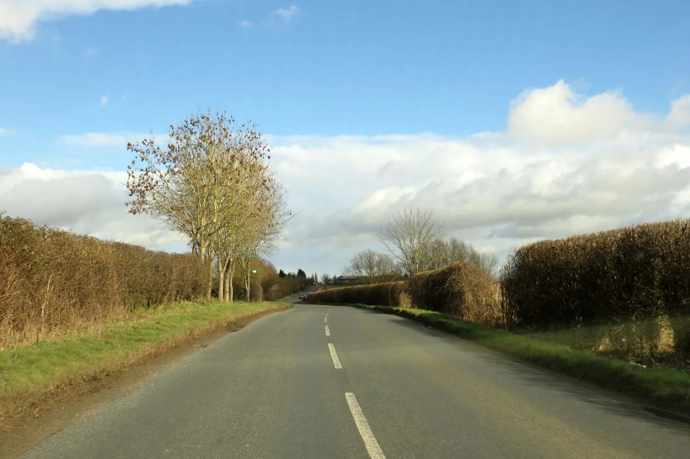

All eight shortlisted routes for a Haddenham to Thame walking and cycling path follow Thame Road and the A418. The survey closes on 24 November.
Two councils have shortlisted eight possible routes for a walking, wheeling and cycling path between Haddenham and Thame, and they want residents’ views by Tuesday 24 November.
Every one of the eight runs along or close to Thame Road and the A418 Aylesbury Road. They are 3km to 4km long. Routes across the fields, towards Long Crendon or through Kingsey were all assessed and scored worse.
Buckinghamshire Council and Oxfordshire County Council opened the survey on Tuesday 20 October. (Buckinghamshire Council, 20 October 2026) Haddenham is about six miles south-west of Aylesbury. Thame is across the county border in Oxfordshire, which is why the two councils are running the work together.
No route has been chosen and nothing has been funded. The councils say a decision on next steps is expected in spring 2027.
Why a route is being looked at
The councils say people have wanted a safer link between the two places, and to Haddenham and Thame Parkway station, “for many years”.
Their exhibition boards set out the problems with the existing options:
- the main roads carry a lot of traffic, often at high speed
- some paths are public footpaths, so cycling on them is not allowed
- some footpaths and bridleways are indirect or hard to follow
- surfaces vary, and some paths are narrow, uneven or muddy for much of the year
- parts of the area flood, and routes have to cross the River Thame, Cuttle Brook and drainage channels
(Haddenham to Thame exhibition boards, Let’s Talk Oxfordshire)
22 options, eight left
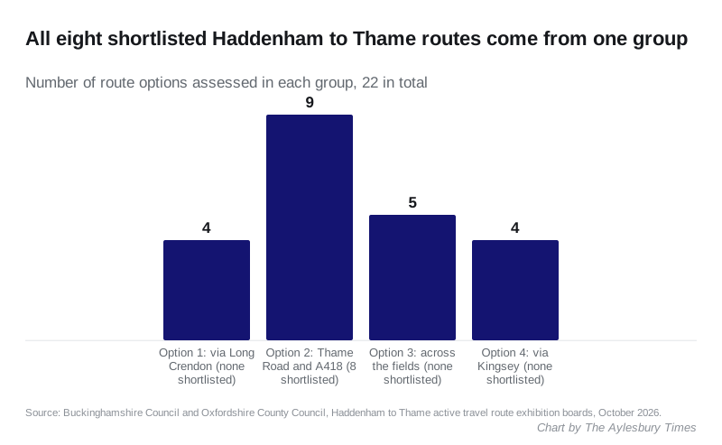
The councils identified 22 high-level options, in four groups. They tested them in two stages, following the Department for Transport’s approach for transport schemes.
The first stage weeded out options with major engineering problems, such as several new bridges, large land needs, or serious harm to wildlife habitats and watercourses. The second scored what was left against the project’s objectives: a route that is safe, direct, legal for cycling and well connected.
| Group | Where it goes | Versions | Shortlisted |
|---|---|---|---|
| Option 1 | North of Thame and south-west of Haddenham, towards Long Crendon through the Crendon Industrial Estate | 4 | None |
| Option 2 | Along Thame Road and the A418 Aylesbury Road, or paths parallel to them, from the station to the Thame roundabout | 9 | 8 |
| Option 3 | Mostly off-road, across fields and open countryside | 5 | None |
| Option 4 | East of both places, towards or through Kingsey | 4 | None |
The boards give the reasons the other groups fell away:
- Option 1 routes are longer, at 5.2km to 5.8km, and less direct. They cross fast roads and the River Thame and run through land at higher risk of flooding. The boards also flag the A418 bridge over the railway on this corridor, which is narrow and has no footway.
- Option 3 routes are pleasant and some are short, at 3.1km to 3.6km, but most cross land that floods, especially south of Cuttle Brook, and pass through areas important for wildlife.
- Option 4 routes are longer, at 4km to 5.4km, and all of them pass directly through areas important for wildlife. Some pass protected trees.
The eight on the shortlist
The councils stress that the shortlist is not a preferred route. These are the options they think are worth studying further, with the route lengths from the options description document:
- 2a (3km): north side of Thame Road, crossing near Mill Lane, then the south side of Thame Road and the A418 to the Thame roundabout
- 2b (3.6km): Thame Road from the station, then Baghill Lane, then the south side of the A418
- 2c (3.4km): through the station car park and on a new path beside the railway, then the south side of the A418
- 2d (4km): Thame Road east into Haddenham, existing shared-use paths near Pilots Place and Pegasus Way, then the A418 over the railway
- 2f (3.5km): north side of Thame Road, then the public footpath on Baghill Lane, then the A418
- 2g (3km): along Thame Road itself, with traffic management to cut traffic levels so cycling on the road is safer
- 2h (3km): like 2a, but staying on the south side of the road throughout
- 2i (3.5km): north side of Thame Road, then public rights of way from Station Road, rejoining the A418 near Scotsgrove
The boards rate 2a, 2g and 2h as the most direct, with a strong link to the station and limited flood or environmental impact. Their drawback is that they need work alongside busy roads and junctions, and possibly land to make the path wide enough.
The other five trade some directness for quieter sections or existing paths. Option 2c would give a new traffic-free link to the station along the railway. Option 2d is the longest at 4km, and it crosses the railway on the A418 bridge, which the boards describe as narrow with no footway.
What the path might look like
The boards show three kinds of path, with examples from elsewhere:
- a shared path for walking, wheeling and cycling, like the Waddesdon Greenway at Aylesbury
- a footway and a separate cycle track
- a path beside the main road but set back behind a grass verge or hedge
Crossings could be toucan crossings, signal crossings with separate lanes, or parallel zebras like the one on Gatehouse Road in Aylesbury. Where it makes sense, the councils also want the route to work for horse riders.
How to have your say
The survey is on Oxfordshire County Council’s Let’s Talk Oxfordshire page and closes at 11.59pm on Tuesday 24 November 2026. Responses are shared with Buckinghamshire Council and with a consultant who will analyse them.
There are two drop-in exhibitions, and there is no need to book:
| Date | Time | Where |
|---|---|---|
| Thursday 5 November | 3pm to 8pm | Haddenham Parish Council Conference Room, Banks Park, Banks Road, HP17 8EE |
| Saturday 14 November | 10am to 3pm | Upper Chamber, Thame Town Hall, High Street, OX9 3DP |
You can also post a response, without a stamp, to Freepost OXFORDSHIRE COUNTY COUNCIL. Write “Haddenham to Thame active travel route” in the top left corner of the envelope. Paper copies and other formats are available on 01865 792422.
Buckinghamshire’s Deputy Leader and Cabinet Member for Transport, Councillor Thomas Broom, said: “We know there’s been local interest in an active travel route for many years, and we hope that this engagement will provide us with some good feedback to understand the viability of the project going forward.”
What it means for you
- Nothing changes on the roads yet. This is an early feasibility stage. There is no design, no budget and no start date.
- If you use the station, this is the stage to speak. All eight options connect to Haddenham and Thame Parkway, but in different ways: through the car park, along Thame Road, or via Station Road.
- If you live on Thame Road, Baghill Lane or near Scotsgrove, the shortlisted routes pass you, and several “could require land”. The maps are in the options description document.
- After 24 November, the councils will review the responses with the technical evidence and decide jointly whether to go on. If they do, the next steps are a preferred route, environmental studies, a preliminary design, another consultation, and finding the money.
Our roadworks and travel page carries the closures affecting the area this week.
Have your say