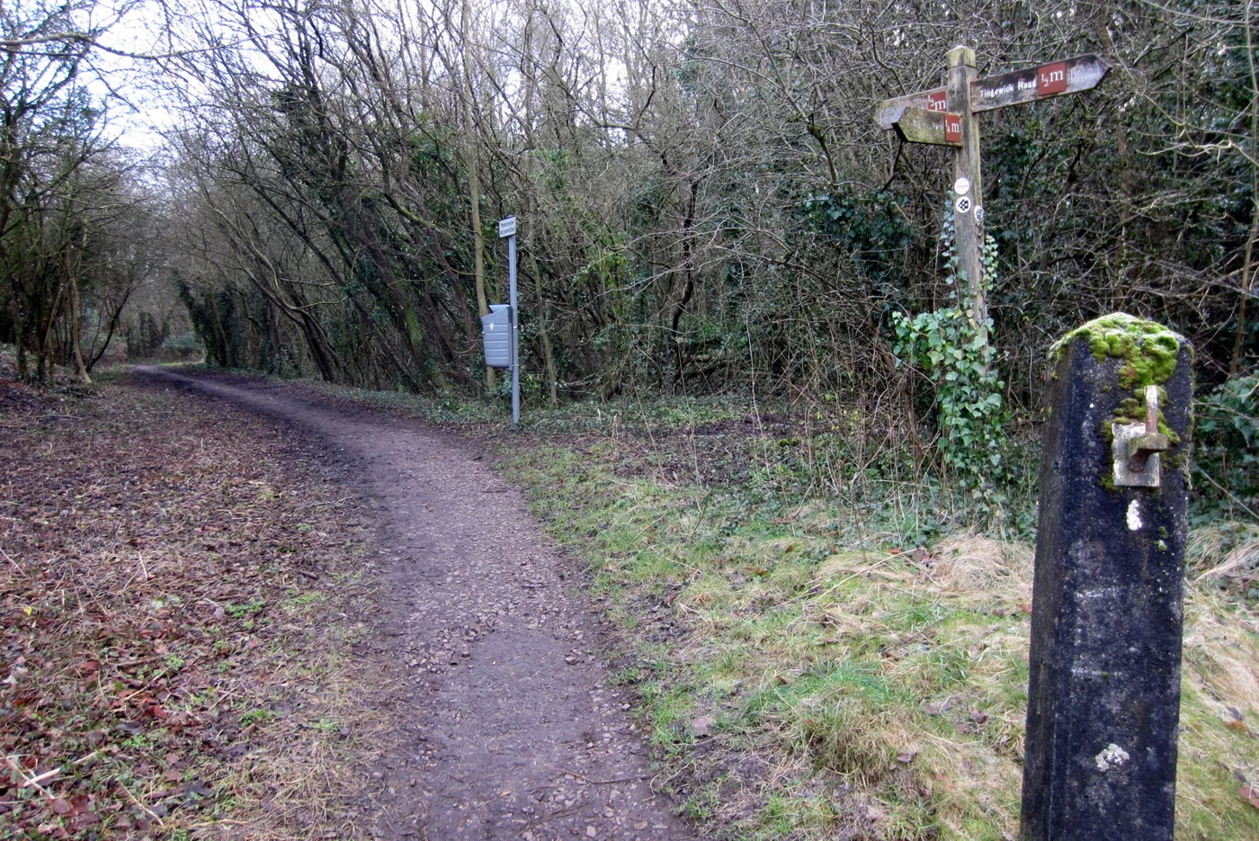

Seven years after the town council applied, the route between Tingewick Road and the A421 goes on the definitive map. As a footpath, not the bridleway claimed.
The stretch of the Buckingham Railway Walk between Tingewick Road and the A421 is to be recorded as a public right of way, seven years after Buckingham Town Council applied for it.
It will go on the map as a public footpath, not as the public bridleway the council asked for. The reason is in the evidence: of 94 people who filled in user evidence forms, and eleven interviewed by officers, not one said they had ridden a horse along it.
Buckinghamshire Council’s Definitive Map and Highway Searches Manager signed the determination on 24 August 2026 and published it the following day. The application, reference 16855ACZ, was made on 14 May 2019 under Schedule 14 of the Wildlife and Countryside Act 1981.
What the 94 said
The application was backed by user evidence forms covering claimed use from 1969 to 2019. Officers assessed the twenty-year period that matters in law as 1999 to 2019, the two decades before the claim was made.
Of the 94, 80 said they used the route frequently. None had ever asked permission or felt they needed to. None had been refused access.
Officers interviewed eleven of them in July and August 2025. All eleven had used the route on foot, six of them also by bicycle. They described using it daily, weekly or monthly, with gaps only for ill health, and said the line of the route has not changed in decades. Much of it is concrete or paved, with muddier unmade sections at the northern end. It is generally one to three metres wide, widening over the railway bridges, which the report describes as “sufficient for two people to pass or a cyclist”.
Witnesses described it as a safe off-road link between the Railway Walk and the Buckingham Circular Walk, giving access to Chandos Road, schools, shops and the town centre.
The landowners, and what they said
Three bodies own sections of the route: the University of Buckingham, Buckingham Town Council and Buckinghamshire Council.
The University bought its section in 1998 and made a case against dedication. It told officers it has:
- put up notices at the car park entrance reading “Private Grounds, No Right of Way dedicated”, from 1998 and updated with a new logo in 2024
- closed the route two or three times a year with mobile barriers for tree works, for one to two days at a time
- turned members of the public away while the car park was being built and resurfaced
The University also said it has no objection to the wider Railway Walk scheme, provided it does not lose long-term rights over the land and the legal costs fall to the project.
Officers were not persuaded that this was enough. Their conclusion is that the Railway Walk “has been used openly, continuously, and as of right by the public for many decades”, that use is “widespread and frequent”, and that the route is “clearly defined, well known, and embedded in the community”.
Documentary evidence, by contrast, produced nothing at all. The Ordnance Survey map of the 1890s, the Radclive tithe map of 1840, the 1910 finance plan and the parish survey map all show the working railway line and no walked route. Aerial photographs from 1999, 2003, 2007, 2013 and 2020 show an avenue of trees along the line, dense enough that officers could not tell whether anyone was using it. As the Town Council put it in its own response, “no one would have been walking along a functioning railway line” before it closed in 1963 or 1964.
What happens next
The decision authorises an Order, not the final entry on the map. The council will now make a Definitive Map Modification Order and advertise it.
- The Order will be open to objections once advertised.
- If anyone objects, the Order and the objections go to the Planning Inspectorate for determination, which can mean a public inquiry.
- If nobody objects, the route is confirmed and added to the definitive map and statement.
The council’s report is candid that this costs officer time either way, and that cost is not a consideration it is allowed to weigh: it has a statutory duty to make an Order where the evidence supports one.
The Greenway running alongside it
Separately, and on a parallel track, Buckinghamshire Council is upgrading the Railway Walk itself. The scheme, worked up with Active Travel England, Buckingham Town Council and the University, would:
- convert sections of the existing permissive paths to shared use for pedestrians and cyclists
- install signalised toucan crossings at both ends, at Tingewick Road and at the A421
- add wayfinding, solar studs and seating along the route
Two automatic counters have already been installed and have been collecting data. Work on the University’s own land is held back to a later phase.
The report also records an internal exchange in September 2025 about creating a bridleway across the sections owned by the town council and the county, and notes that the two processes would run in parallel, with the University section potentially diverted later.
What it means for you
- Walking it becomes a right, not a permission. Once the Order is confirmed, the route between Tingewick Road and the A421 is on the definitive map and the council has a duty to keep it open.
- Riding a horse on it does not. The claim for bridleway status failed on the evidence, so equestrian rights are not recorded. Cyclists are in the same position on the footpath itself, although the separate Greenway scheme is designed to give them a shared-use path.
- If you object, the window is when the Order is advertised, not now. Watch the council’s officer decisions register, where the decision report and supporting documents are published.
- The papers can also be inspected in person at the council’s Walton Street offices in Aylesbury, HP20 1UA, by appointment on 0300 131 6000.
More from us: Aylesbury planning news and things to do in Aylesbury.
Have your say